
Read a Fayette County Parcel Map
Fayette County posts an Interactive GIS map and links West Virginia's parcel viewer through the Assessor's disclaimer page. Both are public. Together they confirm that parcel mapping exists and that each parcel carries an identifier you can cross-check in WV IAS. Neither source lists every live layer or tool. That means the viewer should not be treated as a verified zoning, aerial, flood, or measuring system just because a generic GIS layout appears. Treat it as a map. The record systems beside it carry the proof.
| Layer | What It Shows | Use |
|---|---|---|
| Parcel polygons | Tax parcel location and parcel reference | Orient an address or compare adjacent lots |
| GIS parcel ID | Cross-reference value shown by IAS | Carry the map clue into the assessor record |
| District / Map / Parcel card | Assessor map-card selection fields | Open a card when those components are known |
| Other live layers and tools | Not fully verified in the inspected viewer | Confirm directly before relying on a named control |
Let the GIS orient you first. Then go deeper. Move to WV IAS for the parcel card, and to FayetteDeeds for the legal description, plat, or transfer tied to that parcel number. The County Clerk's recorded document controls what was actually filed. The GIS boundary alone proves nothing legally. When a line matters for a fence, sale, building, or access question, pull the deed and plat, and have a licensed surveyor establish the boundary on the ground.
Fayette County GIS Parcel Map Viewer Limits
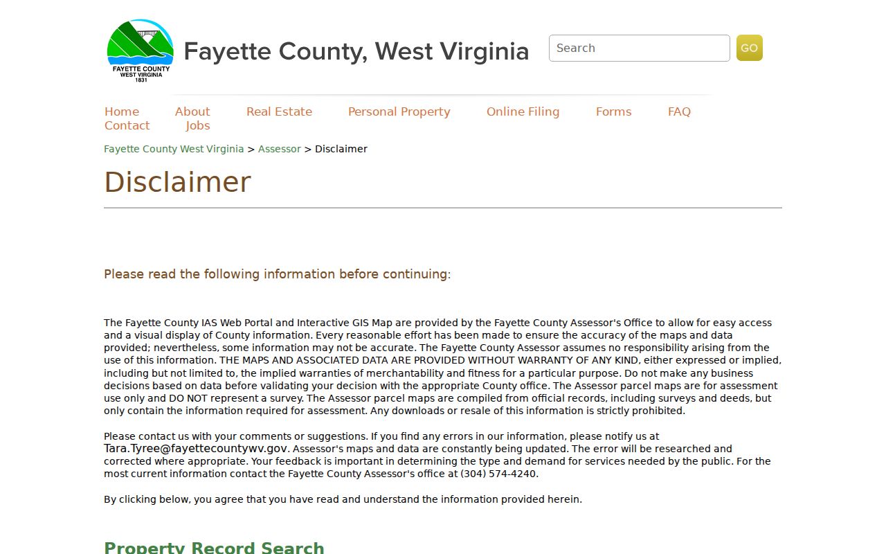
Fayette County's own disclaimer is blunt. It says the GIS and assessment map may be inaccurate and come without warranty. The map is compiled from official records, including deeds and surveys. Yet it holds only what assessment work requires. The county tells users to confirm with the appropriate office before acting. It states plainly that the parcel map is not a survey. It also prohibits downloading or reselling the data. Heed that language. A polygon that seems to cross a driveway, stream, steep slope, or old road deserves a second look. Check the deed records, not the screen. The map can find a parcel and a record reference. But the County Assessor is where map errors get reported and a current card gets pulled. A true boundary question needs the deed description. It needs a survey whenever stakes or improvements depend on the line. The ArcGIS view publishes no dedicated buffer, adjacent-selection, or measure tool.
Fayette County Parcel Map Cards and GIS
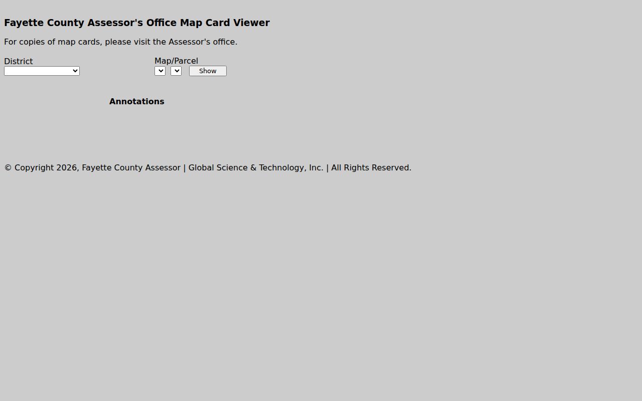
The live GIS and the Assessor's map-card viewer handle different jobs. The GIS is the spatial half. It helps you locate a parcel among roads and neighboring land. The map-card page serves a different crowd. These are people who already hold District, Map, and Parcel values and want the card image those numbers unlock. The county says cards are updated often. The most current version is the one viewed at the office. Do a map label and card disagree? Compare the full parcel ID and the deed's legal description first. Decide one of them is wrong only after that. Remember what a card is. It is an assessment document, not a boundary survey. A first look at Oak Hill's Minden annexation area works fine on the map. The same goes for a rural tract. But the Clerk's recorded plat or boundary instrument carries the written land context that settles questions.
Locate a Fayette County Parcel Map Record
Begin with a street or parcel clue in the county-linked GIS. Then check the result against the assessor's WV IAS record. The two should agree. The map-card viewer is a separate tool. It wants District, Map, and Parcel selections before it opens anything. WV IAS goes further. It adds a Sub-Parcel field and displays a full parcel ID or GIS parcel ID. No stable public instructions document the punctuation or prefix conventions. So take the returned key exactly as the portal gives it and skip reformatting.
- Search the known address or parcel in the county-linked GIS or WV IAS.
- Record the displayed district, map, parcel, sub-parcel, or GIS ID exactly as shown.
- Open the map-card viewer with District, Map, and Parcel when those values are known.
- Compare the assessor legal description and deed book/page before treating the shape as the same tract.
- Use a recorded plat or survey for lot lines and call the Assessor about a map correction.
Keep the parcel key exactly as the county portal displays it. Leave the district and any sub-parcel component alone. A parcel card earns its keep when several lots share one address, when a land-and-building account carries a separate map reference, or when a road name changed after the deed was recorded. The card opens through District, Map, and Parcel values. WV IAS may also show a sub-parcel and a GIS parcel ID. Those keys let you move between interfaces cleanly. They do not certify that a shape is current, or that two lots drawn side by side share a legally surveyed line. The deed records decide that.
- Parcel ID
- The assessor’s account key, shown by district and parcel components.
- Plat
- A recorded drawing that lays out lots, roads, and shared areas.
- Lot and block
- A parcel description that points to a recorded plat.
- Metes and bounds
- A written boundary description using measured lines and calls.
Fayette County Plats and Surveys
The Fayette County Clerk indexes recorded plats under PLAT and CONDO PLAT instrument groups. The deed interface searches by subdivision, lot, block, book and page, description, date, and party, so it can reach a plat when the parcel card falls short. A subdivision plat shows lot numbers, roads, common areas, and dedications. Read beyond it, though. A later deed may add an exception, reserve minerals, combine tracts, or describe an easement, so that later instrument matters as much as the plat itself. The Clerk's historic guide also lists surveys from the 1780s and from 1817 to 1876. For an old tract, search a survey name, book reference, or legal-description phrase, then lean on the library or WVU archive for microfilm and collection help. A plat explains the record context. Marking a legal boundary on the ground still takes a licensed survey.
Minden and Fayette County Boundaries
Boundaries and mailing labels do not always agree in Fayette County. Oak Hill's Minden-area annexation application covers a 2,484-acre proposal. County minutes mention a small adjustment. They also note city service extending past current limits. So a parcel can change its municipal jurisdiction. The county still holds the tax roll and deed records. Never rely on a mailing city, ZIP, or city permit file alone to place a parcel.
Check the current county GIS map against the town's boundary map. Also check any commission order or recorded legal description. Minden gives Oak Hill a good reason to dig into historical boundary context. For Fayetteville, the town's interactive limits map is the tool to use. When the question turns on ownership or taxes, the Fayette County assessor and the Clerk remain the core property records sources.
Fayette County Map Data Access
The county GIS disclaimer prohibits downloading and reselling its map data. A public map link does not grant a right to copy the dataset for redistribution. Contact the Assessor at 304-574-4240 to request a corrected parcel card or source map. Ask which record is available. For a recorded subdivision plat, search the Clerk's PLAT category. Or request a specific book and page.
Neighbor questions often start with one subject parcel. Treat adjacent IDs on the map as a lead, nothing more. The county offers no named buffer or adjacent-selection control. So compare visible adjoining polygons by hand, then pull each assessor record through IAS. Never quote a measured distance or a legal common line from the display.
What Fayette County Parcel Maps Cannot Prove
A Fayette County parcel map is a starting point, not proof. It can locate an assessor account and turn an address into a record key. It cannot fix the legal corners of a lot. It cannot settle whether a fence sits on the line. Nor can it stand in for a recorded deed, plat, or current survey. The County Assessor labels the map assessment-only and disclaims any warranty. Where a boundary touches a purchase or construction, be careful. The same goes for access and disputes. Trust a professional survey and the recorded deed records.
Not a survey. Fayette County’s GIS lines are reference data. Before building on or disputing a boundary, compare recorded documents and obtain a licensed survey.