
How a Fayette County Property Search Works
For a first lookup, use West Virginia IAS. It is the state assessment interface linked from the Fayette County Assessor. Pick the county. Then enter a street clue, an owner name, or a piece of the parcel number. An address search is the easiest starting point. Still, a rural route, a street-name variation, or multiple parcels at one situs can muddy the results. Once a result opens, copy the full parcel ID and the legal description. Do this before you leave the page. Those two details carry you into every other county record.
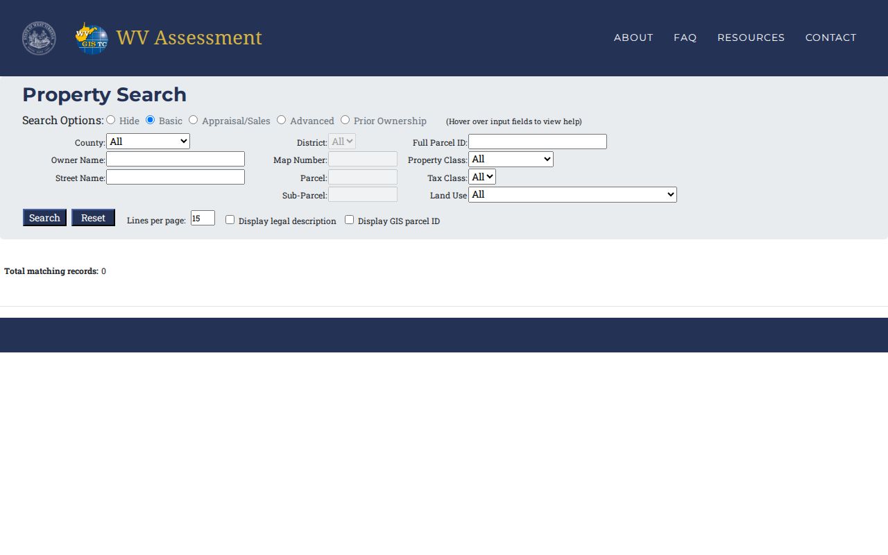
- Search WV IAS by street, owner, full parcel ID, or separate district, map, parcel, and sub-parcel fields.
- Save the owner, mailing address, situs, legal description, deed book and page, and displayed GIS parcel ID.
- Use the owner or description in FayetteDeeds to find the recorded instrument that supports a transfer.
- Open the assessor map card or GIS reference when the parcel’s location, district, or nearby lots matter.
- Contact the Clerk, Assessor, or Tax Office for a current copy or bill detail that the public screen does not settle.
No single database holds everything. A property search in Fayette County is really a chain of cross-checks across offices. The assessor roll identifies the tax account. The Clerk's index lists recorded instruments. The Sheriff's Tax Office handles bills and delinquency. A map connects each parcel to its surroundings. If a transfer was recorded recently, FayetteDeeds may show it before the Assessor's owner field catches up. The county publishes no fixed update interval.
Fayette County Property Search Fields in West Virginia IAS
The WV IAS search form offers more than a street box. Exact parcel keys sit alongside filters that trim a long list of county accounts. The field labels matter. Owner and mailing address are not the same as situs. "Deeded acres" and calculated acres measure different things. The sale date and price point to a recorded transfer event, not to a fresh appraisal.
| Field group | Type | Use in a search |
|---|---|---|
| County, District | Selection | Limit the statewide interface to Fayette and a district. |
| Full Parcel ID; Map, Parcel, Sub-Parcel | Exact or component key | Return to a known parcel across assessor and map-card routes. |
| Owner; Street Name; Mailing Address | Name and text | Use the clue available, then compare situs and mailing results. |
| Class, Tax Class, Land Use, Flood Hazard | Filter | Narrow by recorded assessment category or hazard flag. |
| Land, Building, Total Appraisal | Minimum and maximum | Find accounts within a stated appraised-value range. |
| Calculated/Deeded Acres; Sale From/Through; Price | Range | Focus on land size or a time and price window. |
| Building Year, Area, Structures | Range or count | Separate parcels by recorded improvement details. |
| Legal Description; Deed Book/Page; GIS ID | Cross-reference | Carry a result into the deed index or parcel viewer. |
The system does not promise that a partial street query returns every parcel. It may not return every parcel on the block. Treat a street result as a starting set. Then check the map or run a known parcel ID to confirm coverage. Punctuation in displayed parcel references can vary. Preserve the value exactly as returned rather than reformatting it from memory.
What a Fayette County Property Search Result Shows
A Fayette County assessor result is a parcel card, not a deed. The useful fields include the owner-of-record name, mailing address, situs street, district, map, parcel and sub-parcel, property class, tax class, land use, acreage, appraised land and building values, sale date and price, deed reference, and legal description. Some results also show a GIS parcel ID and a map-card link. Field labels can shift between displays. Check the card itself for the exact wording. Whatever appears, the card is the assessor's snapshot of the account.
| Owner of record | Name shown on the current assessment parcel record. |
|---|---|
| Situs and mailing | Property location and owner correspondence address are separate fields. |
| Parcel key | District, map, parcel, sub-parcel, full parcel ID, and GIS ID where displayed. |
| Appraised components | Land, building or improvement, and total appraisal fields. |
| Legal description | May refer to lot/block, a survey, or a metes-and-bounds tract. |
| Sale and deed reference | Indexed sale date/price and deed book/page where available. |
Treat the result with a little caution. The owner field may lag a deed recorded yesterday, the mailing address may not be the property, and no displayed line is a surveyed boundary. A deed's recorded consideration can differ from market value too. Confirm any disputed detail with the source office.
- Situs address
- The address used to locate the property, distinct from a tax-mailing address.
- Owner of record
- The name carried on the assessment roll, not a title guarantee.
- Parcel ID
- The county account key made from district and parcel components.
- Legal description
- The written land description that links a deed to a tract or lot.
Fayette County Property Search Map Cards Need Three Keys
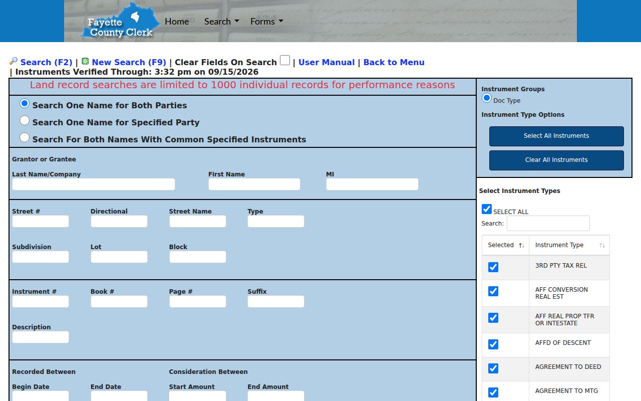
The map-card viewer is a separate route. A searcher arrives holding three keys: the assessor's district, map, and parcel. The page supplies selectors for those parts plus a link to the card image. A card adds a static reference to the parcel record. Even so, the county says cards are updated frequently. It directs readers to the office for the newest version. So treat the card as an assessor document. It is not a survey and not a live deed image.
An address-first search needs preparation. Pull the district, map, and parcel from IAS before opening the viewer. An older deed may give only a book and page. It may carry no current address. Compare its legal description against the parcel card and GIS. Keep that cross-reference intact. A mismatch can signal a divided or combined parcel. It can also mark a historic street label or a description the Clerk must confirm. It is never a reason to quietly alter the number.
FayetteDeeds Search Limits and Coverage
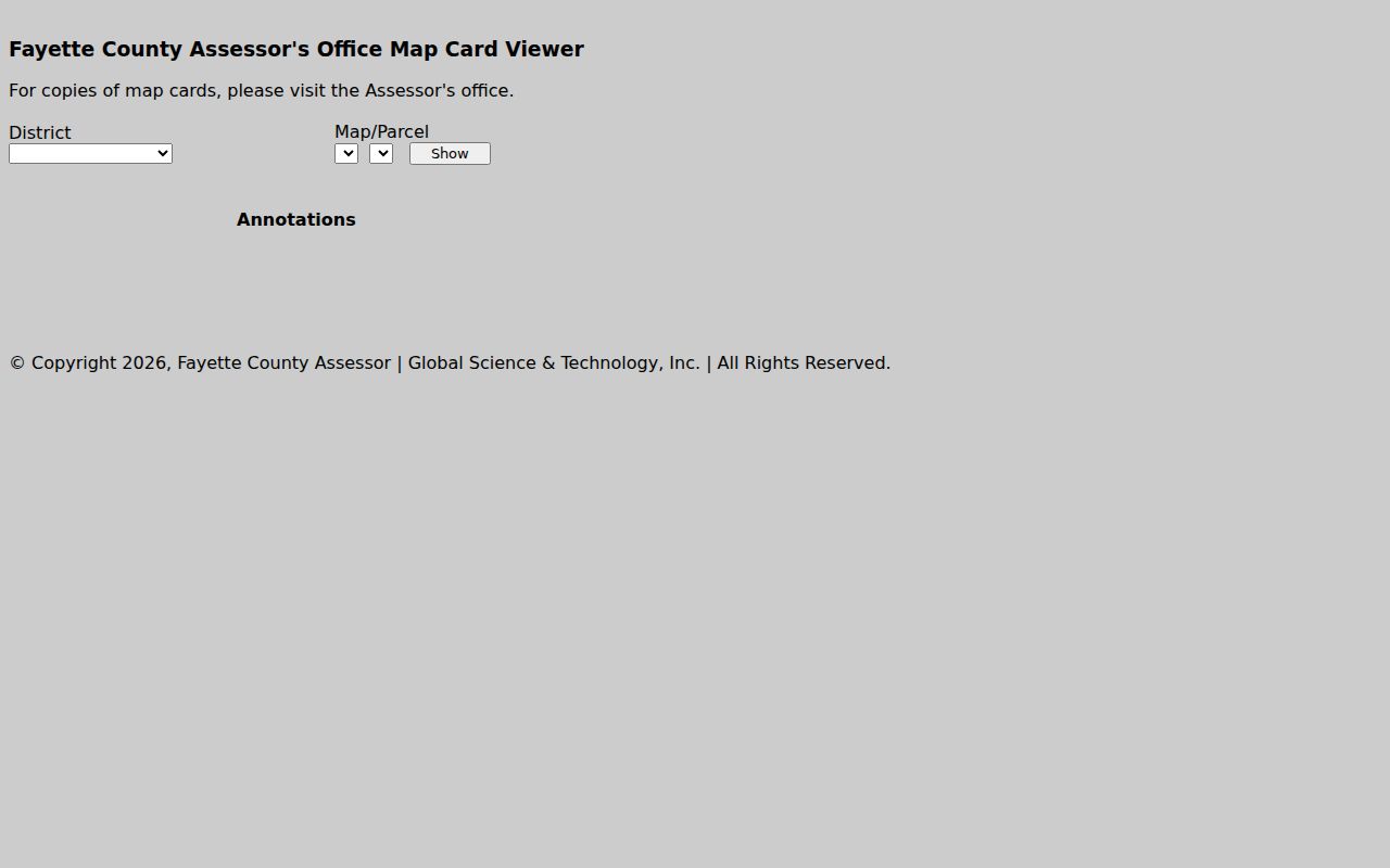
The Clerk's land-record interface offers three search modes. One mode runs a single name against both parties. Another pairs one name with a specified party, and the third matches two names sharing a common instrument. Narrowing tools include street number and name, subdivision, lot and block, and instrument number. Book and page, legal description, recording date range, consideration, and instrument group also narrow the results. A search caps out at 1,000 records. The page also displays the date and time through which instruments are verified. Use those limits to tighten a broad company or family name. A cut-off list is never complete.
The deed index reaches back to 1981. Online images begin in mid-1989. An indexed document may have no image online. In that case, take the record reference to the County Clerk's record room. The portal also carries non-indexed and daily-notebook routes for older or newly filed material. Search by parties and legal description. Rural road names, mailing cities, and current street numbers often disagree with the older record.
When the transfer history itself is the goal, the Fayette County deed-record process is the deeper resource. It explains the Clerk's copy route and historic books in more depth.
Fayette County Property Search by Address, Owner, or Parcel
Pick the identifier that changes least. A street address is easy to remember. But rural routes, renamed roads, and city labels can muddy it. One location may even hold several tax parcels. An owner name brings its own trouble. It can pull up many accounts or a formal entity name. A full parcel number is the strongest key of all. Once a county result has confirmed it, nothing else matches so cleanly. Fayette County's WV IAS fields accept all three routes. The recorded deed index, though, leans on parties, document references, descriptions, and lot and block details rather than any single search term.
| Search Key | Best For | Where It Works | Watch Out |
|---|---|---|---|
| Address | Locate a known home, lot, or commercial site | WV IAS, then county GIS | Rural routes, name variants, and multiple parcels |
| Owner name | Find accounts connected to a person or entity | WV IAS and FayetteDeeds | LLC, trust, estate, spelling, and same-name records |
| Parcel number | Match one assessor account across sources | IAS, map card, GIS | Use each displayed component as supplied |
Not a title search. A Fayette County property search reveals index and assessment records, but it does not prove clear title or resolve every unrecorded interest. A title professional reviews the chain and legal effect of the instruments.
Owner, Mailing, and Situs Fields
WV IAS treats the mailing address and the situs as two different fields. The mailing address may be a post-office box or any address used for correspondence. It does not prove the owner lives on the parcel. That split is useful when two accounts carry similar owner names. Compare the situs and the legal description before you settle on a parcel. The owner field reflects the name on the assessment roll. A deed recorded after the last roll update can name a newer grantee. Fayette County publishes no fixed number of days for that change, and the Assessor advises viewing current map cards at the office. When dates disagree, check the transfer against the latest recorded deed. Then call the Assessor about the current assessment entry.
Fayette County Name Matches
A name search can land several ways. One person may own multiple parcels. Several people may share the same name. A company may appear only under its formal legal entity name. Try a middle initial, a shortened form, or the full business name. Trusts can hide under a trustee or a declaration. Estate entries may carry a fiduciary title or an affidavit of descent. Treat any single name hit as a lead. Confirm it when the parcel description and the deed parties line up. For a company owner, West Virginia's Secretary of State business search helps identify the formal entity name. It also shows the registered agent, status, and address fields. That is context, not a land-title record. Carry the exact entity name to the assessor and FayetteDeeds. There, compare the recorded grantee against the parcel's current owner field.
Fayette County Address and ZIP Clues
Fayette County's mountain roads, town edges, and rural routes make address text an imperfect key. A mailing city may differ from the municipality that controls zoning. An older instrument may spell a street name differently. The County Clerk index offers street number, directional, street name, and type fields. The assessor stores situs and mailing separately. A street query may not settle which account fits. Then search a known parcel or legal description instead. USPS states this plainly. Its ZIP lookup does not confirm a person or business at an address. Use it only to verify the postal label. Then turn to the county GIS or the municipal limits map for jurisdiction. A ZIP code or city name is no substitute for the parcel boundary.
Troubleshoot a Fayette County Property Search
A blank result can have simple causes. A field may be too narrow. A name may be spelled differently. An instrument may not be indexed, or the image may sit outside the online range. Start over with the form cleared and run a broader party search. Then layer in the legal description, a date, or an instrument group. The Clerk’s Non-Indexed Documents and Daily Notebook tabs cover routes that do not act like a standard indexed result. An older chain of title can call for the historic book guide or an in-person visit.
For a tax question, the Sheriff’s Tax Office page links its bill search. It also posts the 304-574-4219 phone route. Its fields and payment behavior are not described here. The Assessor, at 304-574-4240, can speak to the parcel card and owner roll. For recorded documents, the County Clerk at 304-574-4327 is the right call. Have the parcel ID and book/page handy if you know them.